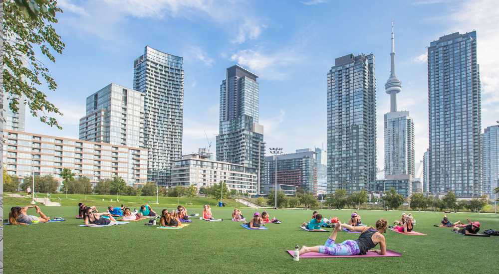
How major developments will forever change the Golden Mile
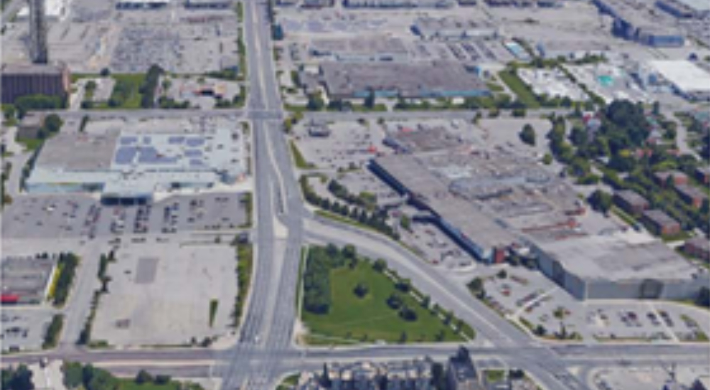
Today the stretch of Eglinton Avenue East between Victoria Park and Birchmount is a mix of chain stores, strip malls and large parking lots, surrounded mostly by walk-up apartments and single-family homes. But billions in public and private investments will transform the “Golden Mile”, into a new downtown that will have ripple effects on the surrounding neighbourhoods.
This is the second part of a two-part blog series on the future transformation of the Greater Golden Mile. The first explored how transit expansion projects would connect the area to the rest of Toronto. Here we focus on massive real estate redevelopments that will transform the Golden Mile into one of the largest residential and commercial communities in Scarborough. To learn more about how United Way Greater Toronto, BMO and other private, public and community partners are working together to ensure the benefits of this development flow to existing residents check out the Inclusive Local Economic Opportunity Initiative (ILEO)
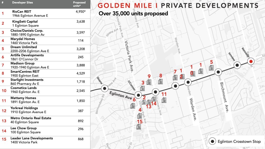
Over 35,000 Proposed Units
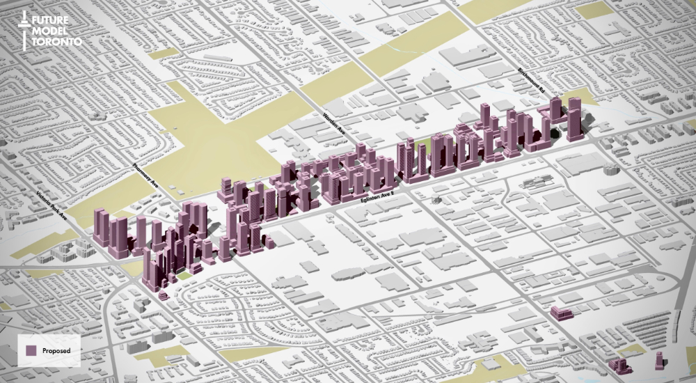
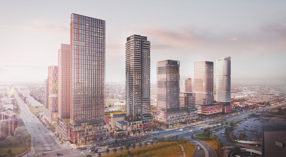
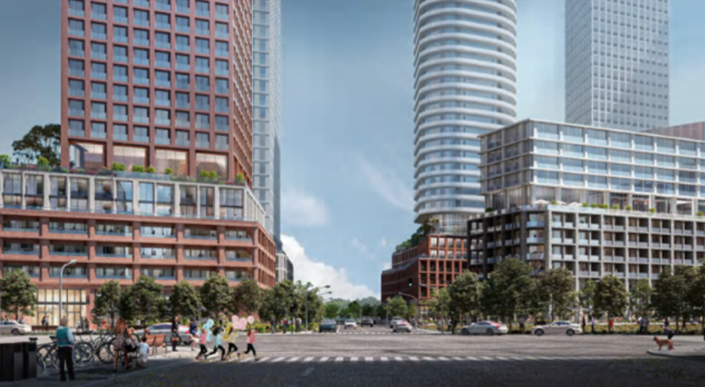
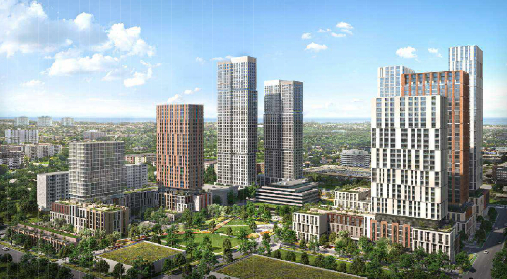
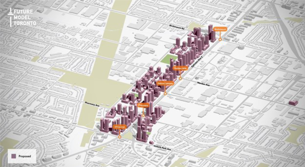
The development proposed in the Golden Mile is one of the largest ever to take place in Scarborough. As of September 2022, developers have proposed over 35,000 new residential units and over a million square feet of retail and office space close to the new Eglinton Crosstown LRT.
These proposals currently include around 75 mid and high-rise buildings, which are expected to house well over 45,000 new residents according to the City of Toronto’s Golden Mile Secondary Plan.
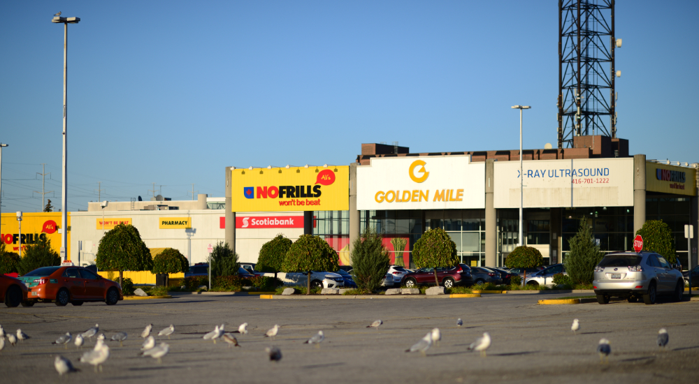
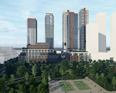
One of the first projects to break ground will be at the site of the Golden Mile Plaza (pictured below), once Canada’s largest shopping centre. Located at the northeastern corner of Eglinton and Victoria Park, it will soon be transformed by developers Choice Properties REIT and The Daniels Corporation into an entirely new community with over 3,500 residential units and accompanying retail and office space spread over several buildings ranging up to 48 stories.
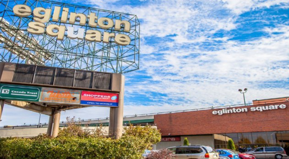
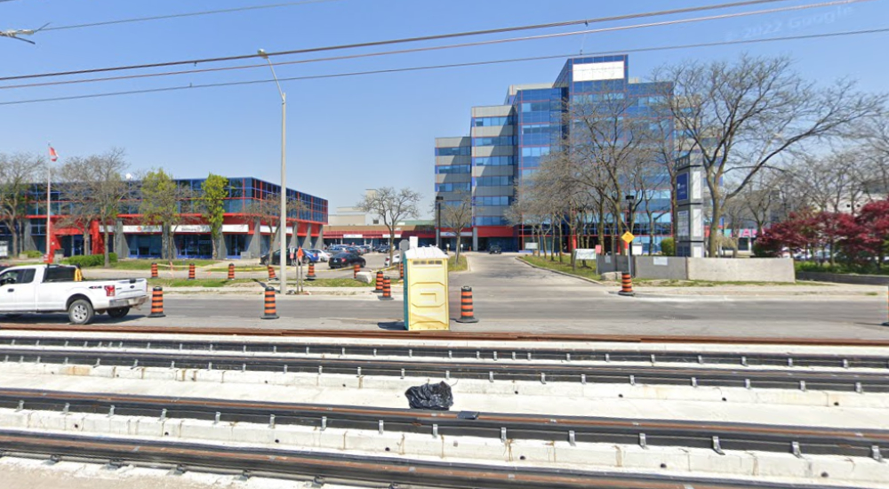
Across the street the land currently containing the Eglinton Square Mall (pictured below) and the Eglinton Square public library. The existing development application proposes over 3,600 residential units across several buildings ranging up to 50 stories with retail space in select areas and a new public park.
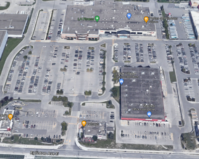
Other notable developments in the area include two proposals on the northern side of Eglinton Avenue by RioCan and Dream (on behalf of Dundeal Canada) for over 4,950 and over 3,200 residential units, respectively. The first phase of RioCan’s development proposal will replace the existing McDonalds, Value Village, Staples and A1 Premium Food Mart with several buildings containing over 2,400 residential units, a new 19,433 m2 park and three new public streets.
Immediately to the east of the RioCan site, Dream is proposing 3,200 residential units across several blocks containing a mix of unit types including purpose-built rentals and townhomes. Two new public parks are also expected to be delivered as part of the redevelopment process.
The scale of the planned redevelopment will change how surrounding neighbourhoods access and navigate local services and amenities during construction, which is likely to last decades. Information about other major development projects in the area is available on the City of Toronto Development Application Centre website.
Triple the size of CityPlace and Regent Park
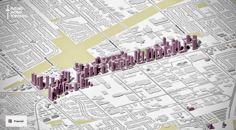
The scale of the development in the Golden Mile is nearly triple that of well-known master-planned redevelopments such as CityPlace and Regent Park in terms of units proposed. For example, CityPlace, when complete, is projected to house approximately 21,000 residents in 12,000 units. But with 13 developers in the mix so far and 32,000 proposed residential units, the Golden Mile is different. Far from being a single master-planned community, redevelopment planned in the Golden Mile encompasses several master plans from developers which will transform the area into a new “downtown” complete with thousands of new residents and jobs close to several transit lines.
Golden Mile
- 280 acres
- 32,000 new units
- 40.000 new residents
- 76 Mid and high-rise buildings proposed
Cityplace
- 55 acres
- 12,000 units
- 21,000 resident
- 31 Mid and high-rise buildings
Data for CityPlace reflect the projected total upon the last phase of redevelopment. According to Concord, CityPlace is already the largest master-planned community in Toronto.
Sources: City of Toronto Application Centre, Concord CityPlace Master Plan, Spacing Toronto Regent Park Progress report.
The Opportunity
There are still opportunities to influence aspects of the development and to ensure that the benefits of the development flow to existing residents. The scale of the redevelopment presents a unique opportunity to significantly increase the supply of affordable housing in the area and negotiate significant other community benefits. For several years, local organizations and residents have been working together to understand the community’s vision for inclusive development, which is captured in the Golden Mile Community Benefits Framework.
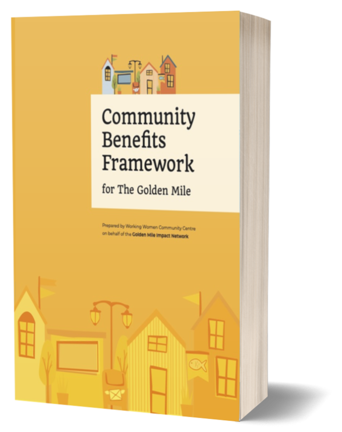
Community Benefits Framework
for the Golden Mile
Prepared by Working Women Community Centre on behalf of the Golden Mile Impact Network.
Together with investments in public transit, this redevelopment presents a once-in-a-generation opportunity to ensure that all residents can benefit from the jobs, business, and other economic opportunities that will come to the area.
Find out more about how United Way Greater Toronto BMO and many other private, public and community partners are working together to increase economic opportunities in the Greater Golden Mile through the Inclusive Local Economic Opportunity Initiative (ILEO).
About the ILEO Initiative
The Inclusive Local Economic Opportunity (ILEO) Initiative brings together the private, public, and community sectors to find innovative ways to reduce gaps in economic prosperity at the neighbourhood level. ILEO is convened by United Way Greater Toronto and BMO. Learn more about ILEO Joint Venture.
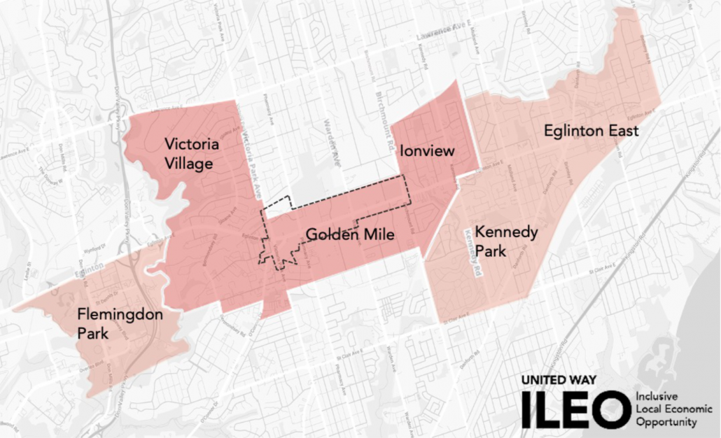
About the Greater Golden Mile
Are you a resident of the Greater Golden Mile? Visit the ILEO website and ILEO Golden Mile Facebook page to learn more about current job and entrepreneurship opportunities available to residents living in the Greater Golden Mile area. The Golden Mile is a commercial district in Scarborough on the east side of Toronto and is one of Canada’s first model industrial parks. The Greater Golden Mile is comprised of neighbourhoods near the Golden Mile district that are the focus of investment as neighbourhood improvement areas. These include Victoria Village, Ionview, Flemingdon Park, Eglinton-East, and Kennedy Park1


1 Through internal analysis and cross-sector engagement with partners including UWGT, the City of Toronto designated 13 priority communities as Neighbourhood Improvement Areas that need additional investment to combat specific problems such as higher-than-average crime or shortage of services. To learn more, see this page
The ILEO Initiative brings together the private, public, and community sectors to find innovative ways to reduce gaps in economic prosperity at the neighbourhood level. ILEO is convened by United Way Greater Toronto and BMO Financial Group.